Summary
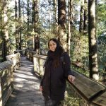
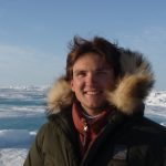
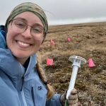
This video is part of the PacSci Career Corner video series, where STEM professionals share their personal journeys into STEM fields and answer student questions. The goal of the video is to inspire K-12 students by showcasing different STEM career paths. In this episode, Katie Braun, an Earth Systems Geographer from the University of Wisconsin-Madison, talks about her work using maps and remote sensing to monitor the Arctic Tundra in Alaska. The Mapping Arctic Changes video is a great resource to connect with lessons on remote sensing, Earth systems, and climate change monitoring.
Materials and Preparation
No specific preparation is needed, but educators may want to pre-watch the video.
The video is 7:41 minutes in length. This can be shared at any point in a lesson related to the video topics or shared as a resource for general career readiness.
Learning Objectives
Activity Overview
Share video link with students to watch together as a group or asynchronously.
Reflection
After watching the Career Corner video, guide students through reflection on either career pathways or connections from Katie’s experience to key concepts currently being taught in the classroom.
Example reflection questions:
- What did you learn about how maps and remote sensing can help scientists monitor changes in the Arctic Tundra?
- How does Katie Braun’s work as an Earth Systems Geographer contribute to our understanding of ___? (Earth systems, climate change, use of remote sensing tools, etc)
- What skills or tools do you think are important for someone working in the field of Earth systems and remote sensing?
- After learning about Katie Braun’s career, what other STEM fields or careers would you be interested in exploring?
Supporting Documents
Katie’s shared career experience connects to the following NGSS DCIs:
- ESS2.A: Earth’s Materials and Systems
- ESS2.C: The Roles of Water in Earth’s Surface Processes
- ESS3.C: Human Impacts on Earth Systems
- ETS1.A: Defining and Delimiting Engineering Problems
- ETS1.B: Developing Possible Solutions
References:
Special thanks to Katie Braun for her collaboration in the field and on the video.
Katie Braun: https://geography.wisc.edu/staff/braun-katherine/
University of Wisconsin Madison and Earth Sense Lab: https://www.youtube.com/@EarthSenseLabUW-Madison
Polar Literacy: https://polar-ice.org/
Next Generation Science Standards (NGSS): https://www.nextgenscience.org/
NGSS Science Standards:
Polar Literacy Principles:
New technologies, sensors and tools — as well as new applications of existing technologies — are expanding scientists’ abilities to study the land, ice, ocean, atmosphere and living creatures of the Polar Regions.
Resource Developed By
To learn more about this project
View ProjectMade possible with funding by the U.S. National Science Foundation Award #2221990. The information contained here is those of the author(s) and does not necessarily reflect the views of the U.S. National Science Foundation.