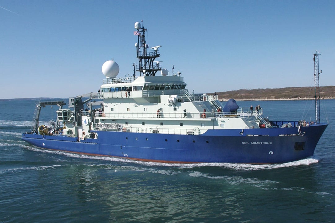
The US academic research vessel RV Neil Armstrong departed from Nuuk, Greenland in early October. On the first leg of our journey, the science team’s initial purpose was to collect water samples and previously deployed instruments along a line of moorings at the southern entrance to Baffin Bay, a gateway between the Arctic and the north Atlantic. This line stretches from Sisimiut, on the west side of Greenland, to just off Cape Dyer, near the Canadian coast.
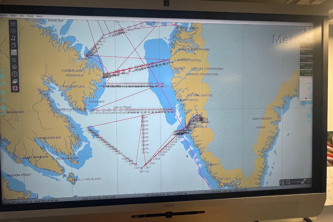
Then we headed north to collect water samples along a northern line of stations, stretching from near Kekertuk on the eastern Canadian coast, toward Disko Island on the western coast of Greenland.
On October 15th, we broke off halfway along that northern line to go even further north into Baffin Bay, to a point due east of the Buchan Gulf. When we arrived, we retrieved a bottom pressure recorder (BPL) device from near the center of the Bay.
On the return leg of the trip, we’ll return to the northern line and finish collecting water samples from the middle of Baffin Bay moving east toward the Greenland coast. Then we’ll return to the southern mooring line to replace the moorings recovered earlier in the cruise, and do more sampling along three lines in the Labrador Sea, before returning to Nuuk.
Who’s on this ship?
Five research groups, including sixteen scientists from nations including Greenland, Denmark, Belgium, Canada, the United Kingdom, and the United States, are on board. The teams are conducting research in physical and chemical oceanography as well as in marine biology. We are collecting water samples at dozens of locations, in addition to retrieving instruments that were deployed two years ago in order to collect their data and sending down new ones to collect the next two years’ worth of information. This group has been working together for about twenty years now, a very fruitful long-term collaboration.
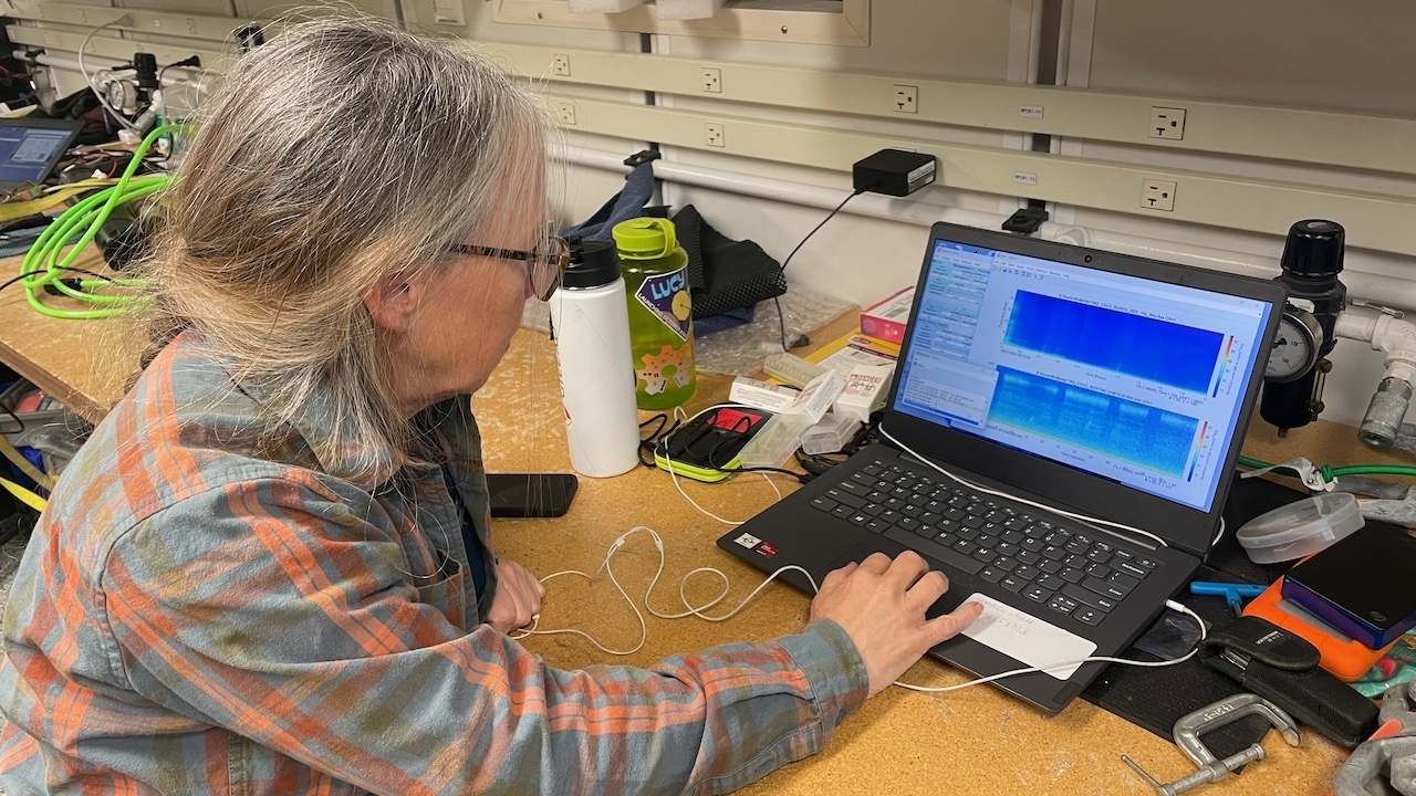
For this trip, I’ve been paired with researcher Kate Stafford from Oregon State University. She works with a research group of physical oceanographers who are retrieving various instruments from mooring lines and collecting their data, then sending new instruments down into the ocean. Kate analyzes data from hydrophones that capture audio every five minutes. She uses the resulting audio files to help track whale migration and shipping traffic patterns over time.
Two research groups on board are studying living creatures in the water samples. One group is looking at copepods and other zooplankton, while the second analyzes chemical concentrations in the food web of phytoplankton. Two more research groups are analyzing elements of the chemical composition of the water. While one group is studying ocean acidification, a second group is tracking multiple chemical elements to study the ocean as a means to remove carbon dioxide from the atmosphere.
A wildlife biologist collects daily bird counts from her watches at sea. A graduate student is synthesizing the data sets from multiple projects as part of a thesis looking to illustrate changes over time in the northern Atlantic global ”conveyor belt” of ocean currents. And as a Polar STEAM educator and artist, writing a children’s musical on environmental science issues, I’m the final member of the team.
What instruments are we using to collect all this data?
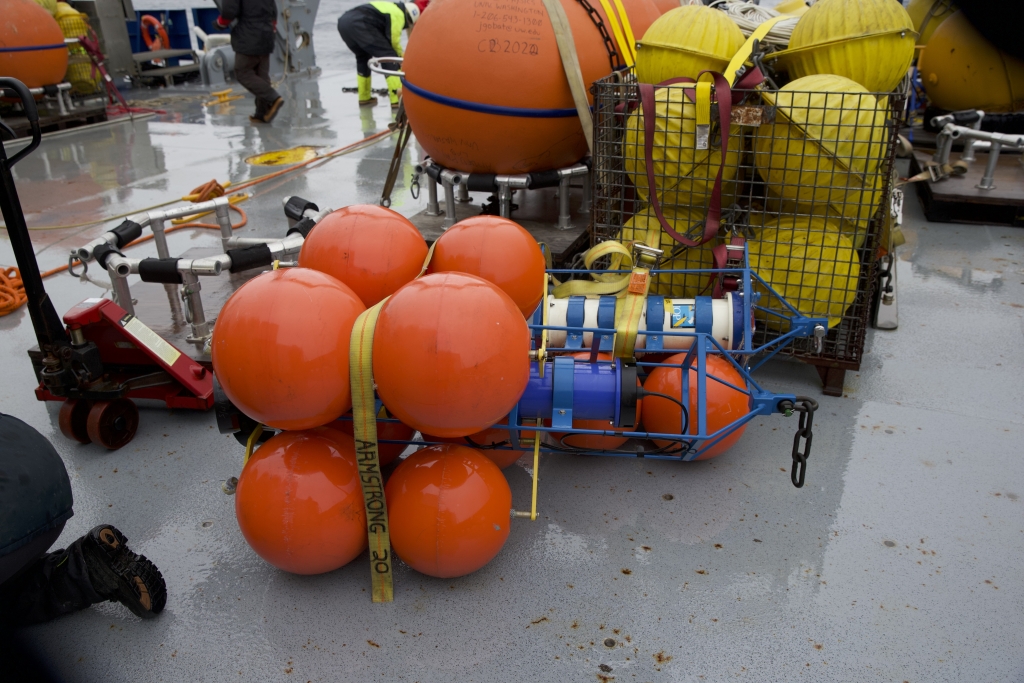
I’m working most closely with the physical oceanography team, so I’m most familiar with the instruments on their mooring lines. They help the physical oceanographers track data in the following ways:
- CTD’s, or conductivity, temperature, and depth sensors, give us a snapshot of water conductivity and temperature at one depth over time. On each mooring line, there are typically 3 or 4 at different depths.
- ADCP’s, or Acoustic Doppler Current Profiler devices, measure the velocity of the current of the entire water column above them. They use sound waves to measure the speed and direction of currents throughout the water column. They sit at 100 meters below the surface at each location.
- Single-bin current meters: these measure the velocity of the current just at 200 and 500 meters below the surface, rather than at all the depths above.
- Fish tag recorders, from Dalhousie University in Halifax, Nova Scotia: These devices pick up pings from tagged salmon, so we can see if any of their tagged fish come through from the north Atlantic.
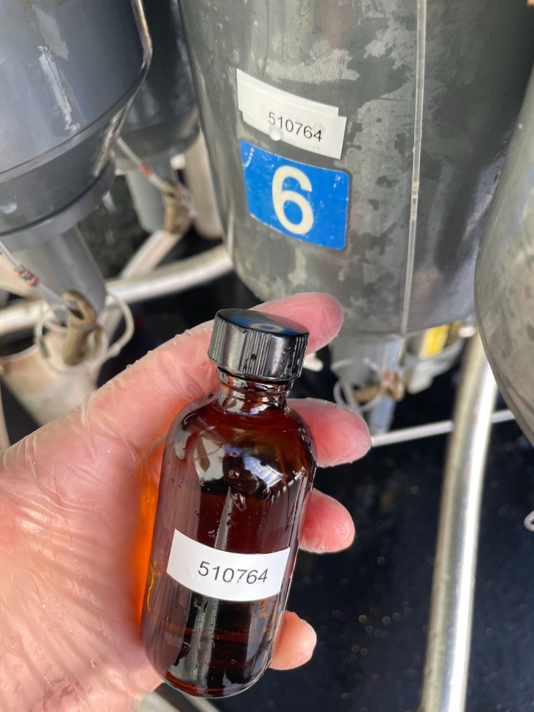
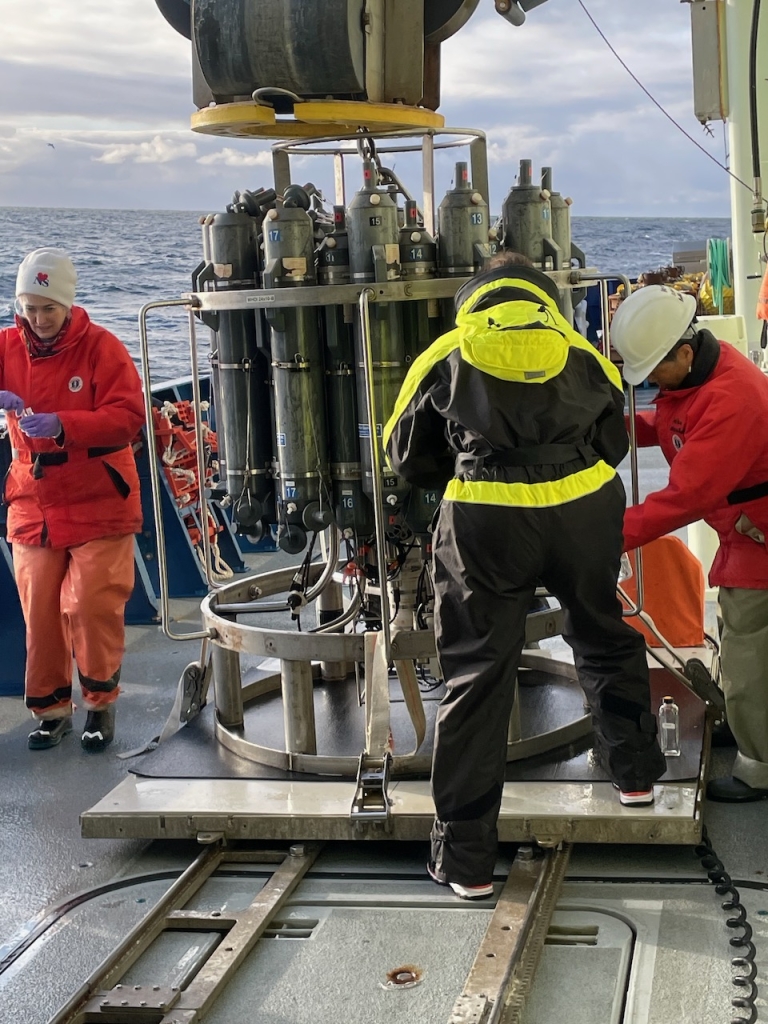
In addition to the instruments from the mooring lines, other science team members on board are collecting water samples at a variety of depths using a tool called a CTD, or conductivity, temperature, and depth, rosette device. Because the CTD instrument is firmly attached to the ship and can be lowered and raised using a winch, water samples can be taken day and night.
Why is collecting this data important?
Measuring currents is a fundamental practice of physical oceanographers. By determining how ocean water moves, scientists can determine how organisms, nutrients, and other biological and chemical constituents are transported throughout the ocean. The ADCPs and single-bin current meters are efficient tools for sampling a large section of the ocean in a limited amount of time.
The audiophone data will help show changes in the timing and location of various whale species’ migration patterns over time, due to climate change’s effects on the Davis Strait waters. This data can help inform decisions about shipping routes that balance economic development concerns with environmental impacts.
While some CTD samples are being put under microscopes to study specific organisms, other water samples will be processed to collect data that will contribute to longitudinal data surveys. These long-term data collection projects are absolutely critical evidence of climate change. They provide physical evidence of changes in water temperature and salinity. This research reinforces what has already been found about warming in the Arctic and the loss of sea ice, and highlights the importance of ocean heat transport in driving Arctic warming and sea ice decline.


